Wednesday, March 13, 2024

Three Ponds Snowshoe: 3/12/24

On a sunny, windy day I headed down to Rumney for a hike, with a bit of a time constraint. My first choice was Rattlesnake Mountain, but thanks to the recent snowfall and frozen snowbanks there was no place to park. Next option was Stinson Mountain, but Lower Doetown Road looked sketchy with the possibility of getting stuck. So I drove up past Stinson Lake and, yay, the Three Ponds trailhead parking was partially plowed. I hadn't been to the remote and beautiful Three Ponds area in winter in many years, so this was an appealing backup hike.


The first 0.1 mile of the Three Ponds Trail was terribly chopped up with frozen boot holes, but after the Mount Kineo Trail junction a snowshoe track emerged under a few inches of new powder. The track was quite narrow and uneven, making for awkward, tightrope snowshoeing. But it was easier than breaking trail through a foot of mealy snow alongside the track.


The main scenic attraction of the Three Ponds area is the numerous wetlands scattered across the basin between Carr Mountain and Mount Kineo. This is the first one seen along the trail, about 0.7 mile in from the trailhead.


A bit farther along I made a short bushwhack to a spacious beaver meadow along Sucker Brook, with a view up to snow-frosted Carr Mountain (3453 ft.).


Looking back along the brook to Black Hill.


A deep firm snowpack provided easy wandering out on the meadow.


Breaking trail on a long straightaway. Most of the first two miles of the trail coincides with a snowmobile trail. But with the snowmobile season in this area having wound down before the recent snowfall, I had this entire scenic basin to myself on this gorgeous March day.


Another trailside wetland with a view of Carr Mountain.


Making tracks through a fine hardwood forest.


A nice area for bushwhacking.


Heading off on a relocated section of the trail on the final approach to the Middle Pond.


Heavy breaking in here.


Arriving at the south end of the expansive Middle Pond, one of my favorite water bodies in the Whites. Whitcher Hill presides to the north.


Had lunch at this trailside opening along the pond.


The elongated mass of Carr Mountain looms to the SW.


Busting through some deep drifts as the trail tracks along the eastern shore.


I figured I might not be able to make the precarious beaver dam crossing to get to the Upper Pond from the Donkey Hill Cutoff junction. I figured correctly.


From here I turned around and bushwhacked SE towards a secluded beaver swamp.


Found it!


A solid snowpack allowed me to wander at will around the wetland.


Looking back from the far end.


Winter has hung on in the Three Ponds basin.


Bushwhacking through open woods back to the trail and the Middle Pond.
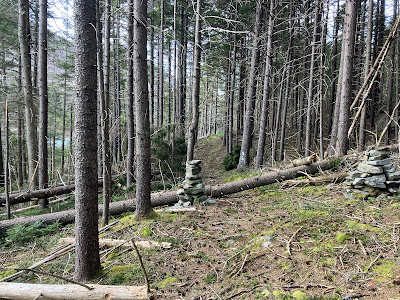


Nice angle on Carr Mountain.


Back at my lunch spot, I did some pole probing and concluded that the pond was still safely frozen up here in its high basin. I headed across towards a sentinel pine that has long been a Middle Pond landmark.


Out on the pond, a great view north to Whitcher Hill and NE to Mount Kineo.


Trailless Mount Kineo (3313 ft.) is a distinctive peak.


Tracks on the pond. With warm days in the forecast, perhaps the last day this was safe for passage this winter.


On the way back I made a short bushwhack to visit the small, circular Lower Pond.


Looking back to the north ridge of Carr.


This is one of the best trailhead kiosks in the Whites. It really sets the tone for a visit to the wonderful Three Ponds area.


Saturday, March 9, 2024

Bald Ledge/Upper Rattlesnake Loop: 3/8/24

I opted for a spring-type bushwhack on a sunny, spring-like day, making a six-mile loop over trailless southern spurs of Carr Mountain. Along the way I passed through a variety of terrain and forests and visited several ledgy spots with partial views, including Bald Ledge (1740 ft.) and a shoulder of Upper Rattlesnake Mountain (2140 ft.)

After hiking just 0.1 mile up the Rattlesnake Mountain Trail off Buffalo Road, I made a steep stream crossing and climbed up a slope to an old logging road that rose steadily to the north.


After a brief stint on an unofficial mountain bike trail called "Dump Run," I angled up and across the slope through open hemlock woods, crossing a couple of brooks.


Down in the drainages there was lingering snow that was quickly turning mushy as the temperature rose into the 40s.


The last time I navigated this route, nine years ago, I followed a brook upstream, enjoying views of numerous cascades. Today there was too much snow down in the drainage to make that enjoyable.


I was happy to climb onto an adjacent hardwood ridge, leaving the snow behind.


Sunny, snow-free hardwoods - this is what I came here for!


I climbed over a little rocky knoll bearing several red pines.


On the back side of the knoll was a tiny pond, like a nature-made bathtub.


Fine open hardwoods, almost like the Catskills, approaching the base of Bald Ledge.


A random rippled crag in the forest.


A lovely little valley below the col on the east side of Bald Ledge.


A true bluebird day.


Climbing through an open oak forest to the top of Bald Ledge.


It's pretty flat at the top.


An old cairn marks the high point of Bald Ledge.


The broad summit area features a group of interconnected mountain meadows.


Smarts Mountain is prominent to the west.


Summit pine.


The southernmost meadow offers a view in that direction, including distant Croydon Peak in the center.


While exploring the meadows, I stepped carefully to avoid trampling lichens.


I took a break in the sun at the largest meadow.


From a nearby spot there was a peek at Mount Cube.


I descended back to the east off Bald Ledge and ascended northeast up another hardwood ridge.


A steep climb brought me to one of the highlights of the trip: a wild assemblage of jutting boulders at the base of a small cliff.


If these were located along a trail, they would be quite an attraction.


The Palisades in miniature.


Neat overhangs.


Fern and lichen riot.


The rock jumble from above.


Looking out.


Twin oaks.


What a neat ridge.


The lower of two adjacent ledges on the ridgecrest.


In the distance: North Moose Mountain in Hanover, Holts Ledge, and Killington/Pico.


The upper of the two ledges.


Mount Cardigan on the horizon.


Mossy wall.


Smarts silhouette.


Peaceful scene.


From the two ledges I made a long and rather rough traverse towards Upper Rattlesnake Mountain. Some of it was through snowy spruce woods.


Other areas were snow-free.


Had to do some postholing.


The mushy snow made this steep drainage crossing unpleasant.


This is rugged country, with a number of confusing ridgelets and drainages.


I was happy to reach the crest of the ridge just south of the wooded summit of Upper Rattlesnake Mountain.


Late in the afternoon I reached the open ledge I was seeking on the Upper Rattlesnake ridge. I first visited this lovely spot when J.R. Stockwell and I traversed the entire ridge from Rattlesnake Mountain to Carr Mountain (a fourteen-hour day) in 2005. (An account of that journey is here.)


Since that visit, the southern view has been "enhanced" by the windmills on Tenney and Fletcher Mountains.


Over the years trees have obscured more of the view.


Parting shot.


The first part of the descent below the ledge was very steep. I came down this leafy chute via crabwalk.


Triple oak.


A lonely old cellar hole 600 feet in elevation above Buffalo Road.


A long descent through snow-free hardwoods, with the sun going down.


The lower section of "Dump Run" gave me a nice walk out for the last half-mile.